Tamar Valley
A beautiful region steeped in history
Are you on the lookout for your next Cornish adventure? Then why not head for the verdant Tamar Valley on Cornwall’s eastern boundary? Pretty villages, water meadows and hillside orchards, industrial heritage, and cut through by the majestic River Tamar…
The lower Tamar
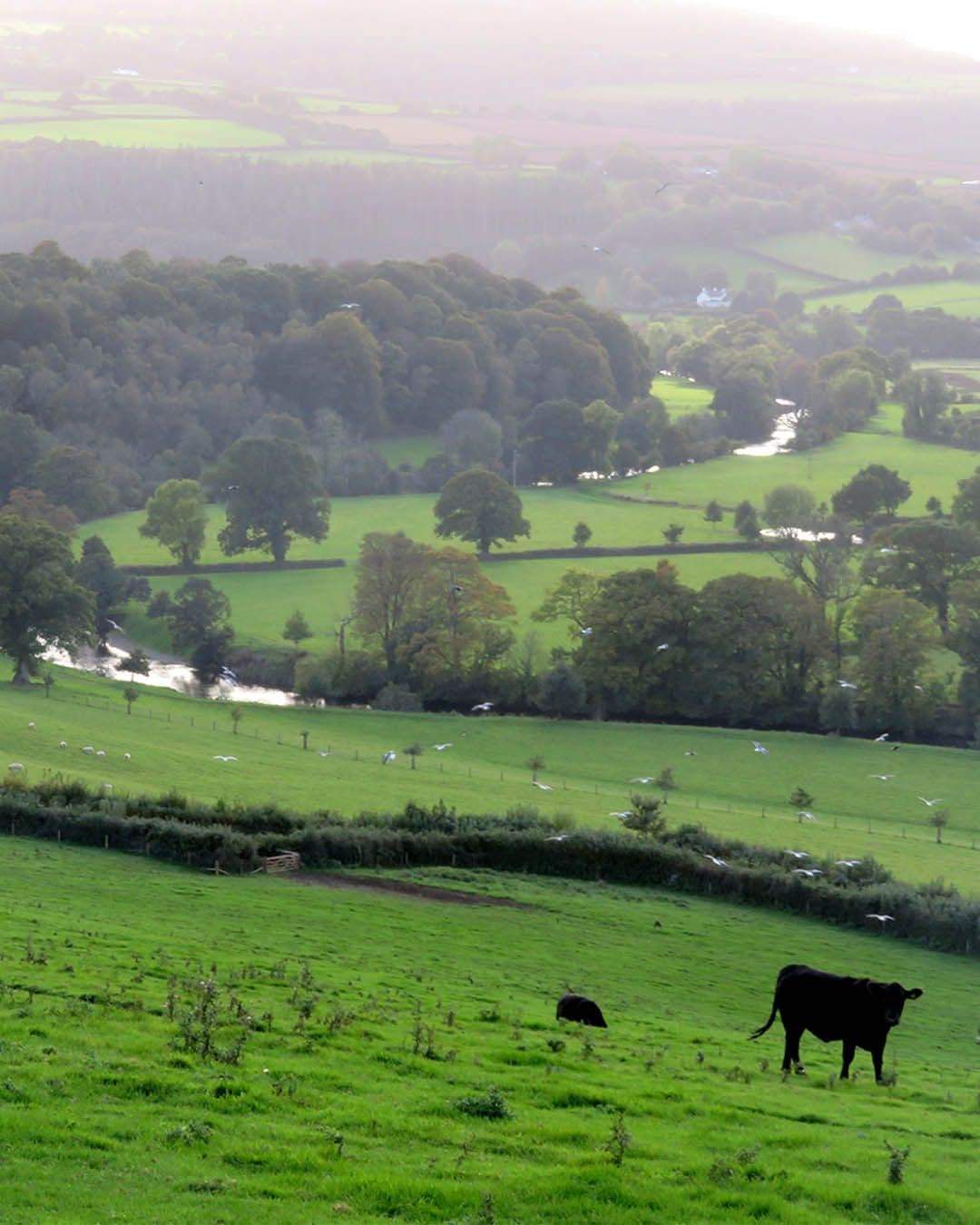
The varied topography of the region, including deep, wooded valleys, pastoral meadows, orchards and meandering rivers, means that no two days in the area are the same. The mining heritage of the area has left its mark with gaunt chimney stacks and lonely quaysides. Some of these have been preserved, including Cotehele, where you can rent canoes to explore the river from a different angle.
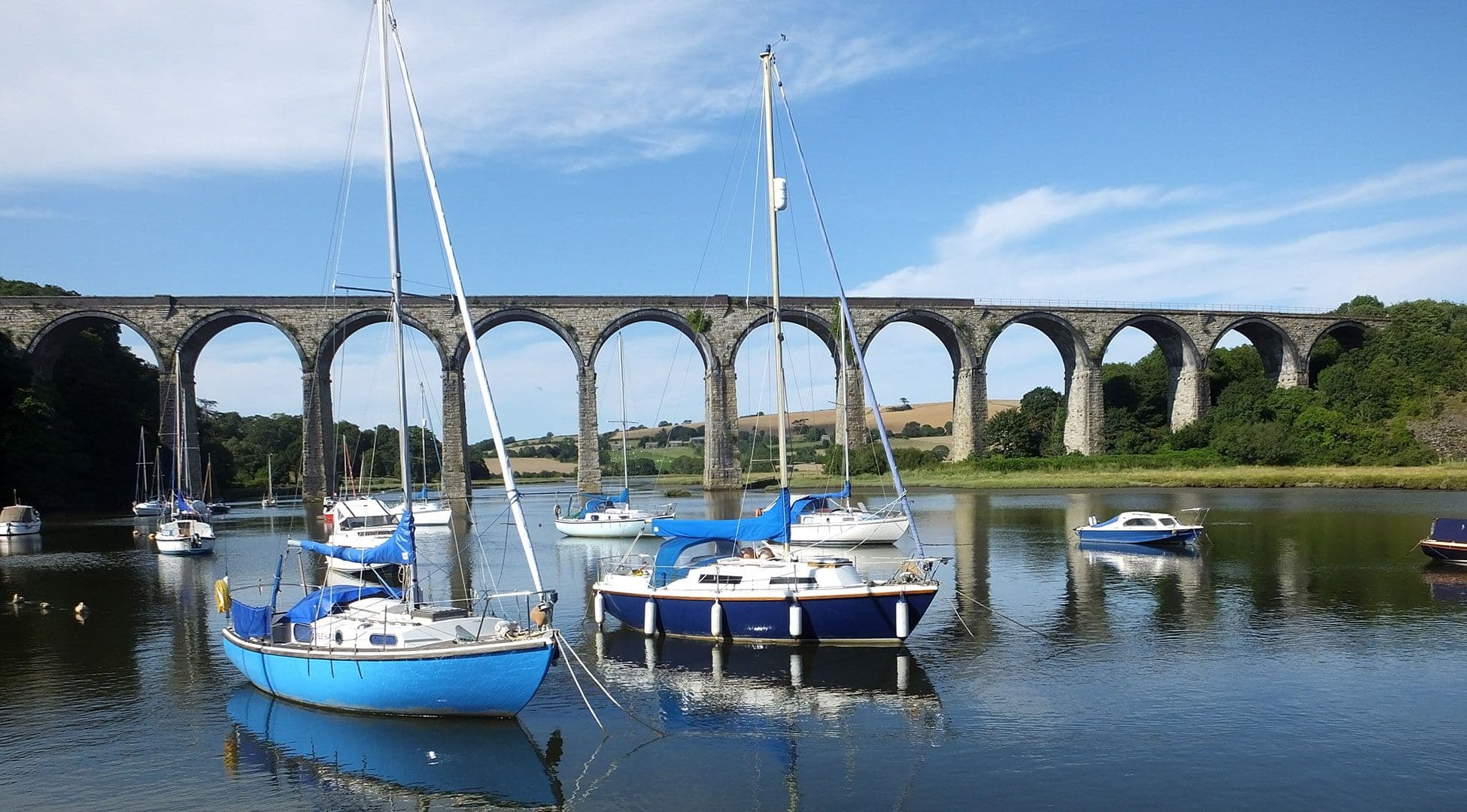
Cotehele House itself is perhaps the most impressive house in the whole area. Owned by the National Trust, this wonderfully preserved Tudor manor still houses a collection of enough tapestries and armour to make Henry VIII jealous. You can take in the house, its gorgeous gardens and the historic quayside by walking downriver from the quiet village of Calstock.
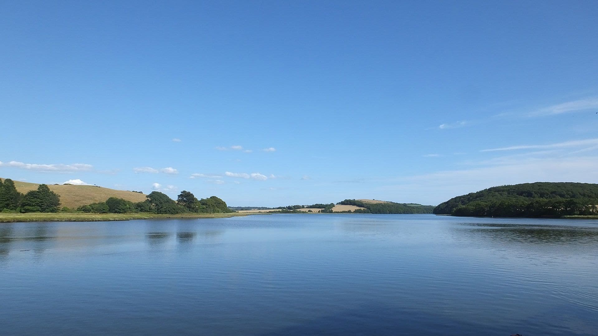
Downstream from Cotehele, it’s not long before the river starts to widen out heading for Plymouth Sound. Halton Quay and Pentillie Castle are passed on long meandering bends before reaching Cargreen and Landulph, by which time the river is at its widest. At Saltash you can stop and marvel at Brunel’s Royal Albert Bridge in all its splendour, carrying the railway into Cornwall, as it has since 1859. Beside the railway bridge is the modern road bridge, for many the way into Cornwall.
The upper Tamar
Above and around Calstock and Gunnislake, where Newbridge, (built in the early 1500s!) offered the lowest crossing point into Cornwall until 1962, the Tamar Valley is part of the Cornwall and West Devon’s World Heritage Sites due to its mining heritage. Abandoned engine houses are dotted across the landscape from the large expanse of Devon Great Consols, just over the border, to the heights of Kit Hill, a country park above Callington.
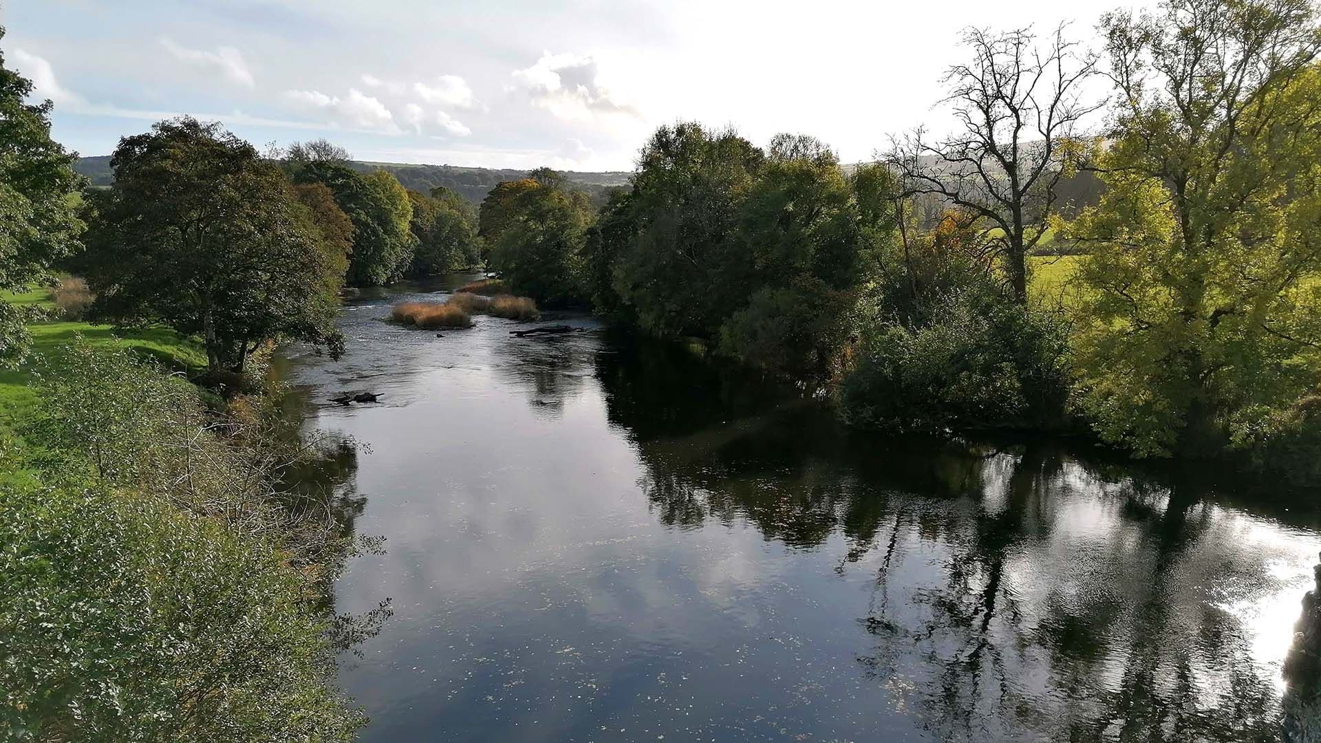
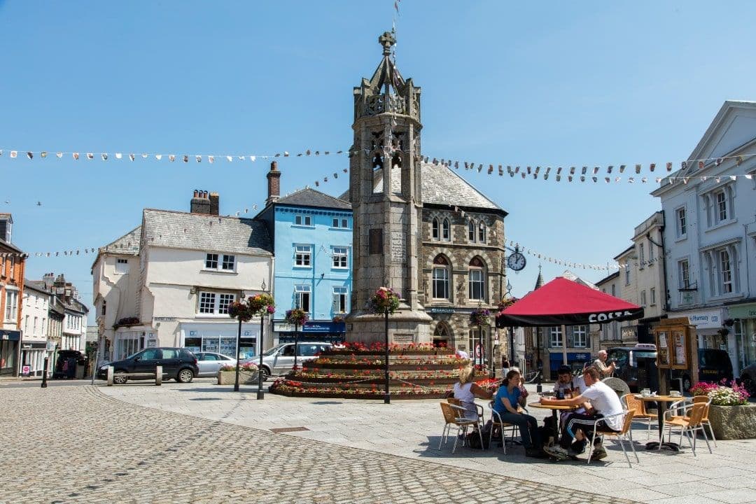
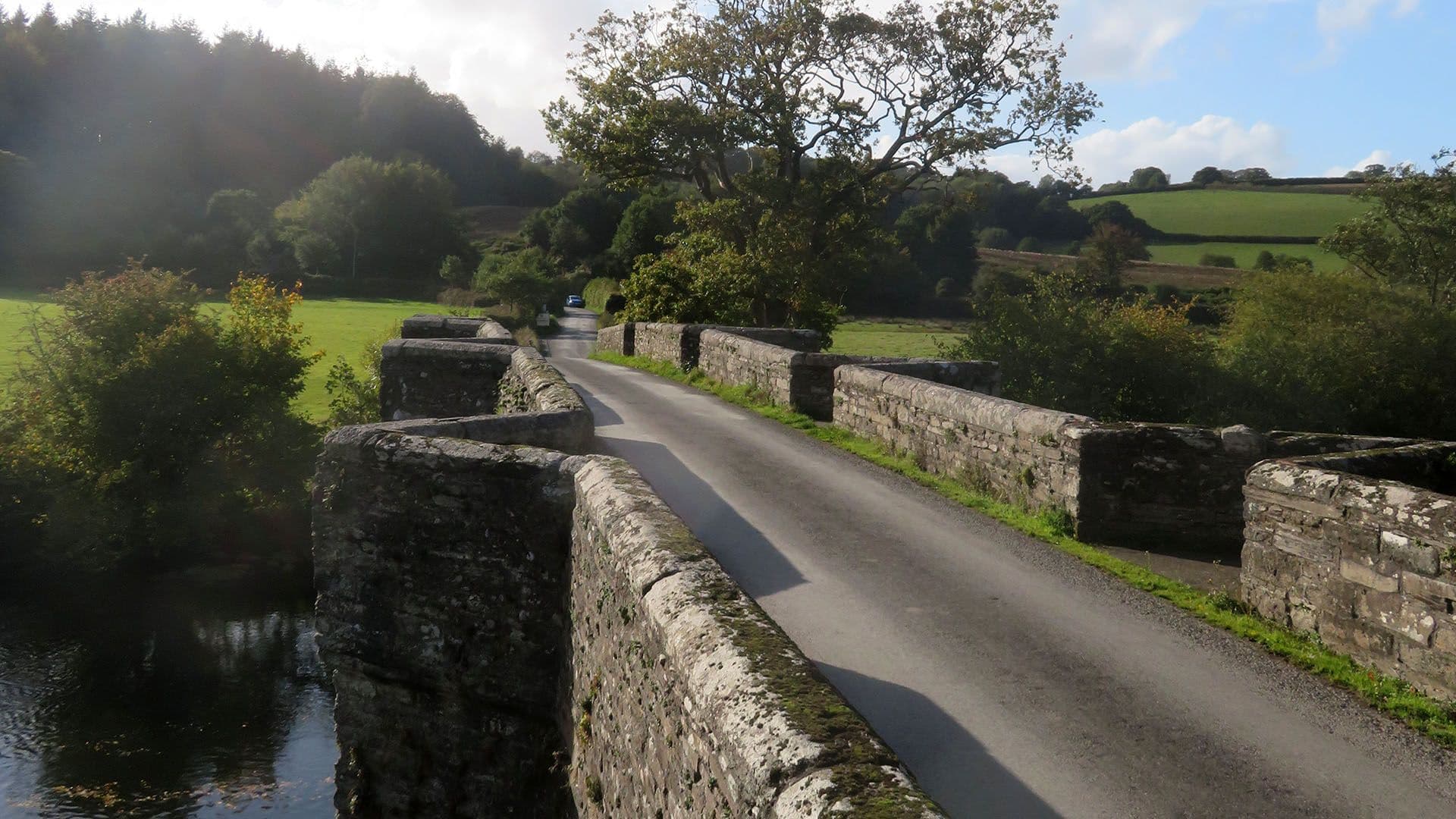
Mining gives way to farmland beyond the village of Luckett, the river flowing beneath Horsebridge, built by the monks of Tavistock Abbey in the 1400s. Villages are far and few, the area more a landscape of tucked-away farmhouses. Between Stoke Climsland and Treburley the River Inny flows down off Bodmin Moor, to join the Tamar, a river now rarely viewed as it flows between dense woodland and rich farmland. It’s crossed by the A30 just outside Launceston, once the capital of Cornwall and still home to impressive castle ruins dating back to Norman times.
Travelling north of Launceston, the river continues to head towards the North Cornish coast, it’s no longer big enough to create a valley and just three miles from the sea it springs into a boggy area near the A39, Atlantic Highway.

Walking in the Tamar Valley
With Bodmin Moor stretching seemingly forever into the west, historic Tavistock and Dartmoor to the east, Launceston’s Norman settlement to the north, and Saltash and the Lynher River to the south, the Tamar Valley area encompasses scenery to take your breath away, adventures aplenty, history on every corner and lots of lovely, welcoming pubs to hang up your walking boots in for that much needed rest…
By getting out and exploring on foot you will discover the best of the area. The Tamar Valley Trail is a 35 mile recreational route that connects the outskirts of Plymouth with Launceston, alternating between both the Cornish and Devon side of the valley. You can also access much of it using the Tamar Valley branch line, if you just fancy doing short stretches.
The River Lynher
Although not the Tamar, the Lynher is part of the Tamar Valley National Landscape and joins the Tamar as it flows into Plymouth Sound. The towns of Saltash and Torpoint sit either side of the rivers mouth, facing across to Plymouth. Nearby to both towns are pleasant walks down to the river, the Churchtown Farm nature reserve on the Saltash side and Antony Woodland Gardens on the Torpoint side.
Apart from these two areas, the access to the waters edge is somewhat limited, though there are a few places alongside the A374 leading out of Torpoint where you can stop. Below Saltash, the Forder Valley offers interesting walks along a creek out to Antony Passage, passing under the viaduct that takes the railway down through Cornwall.
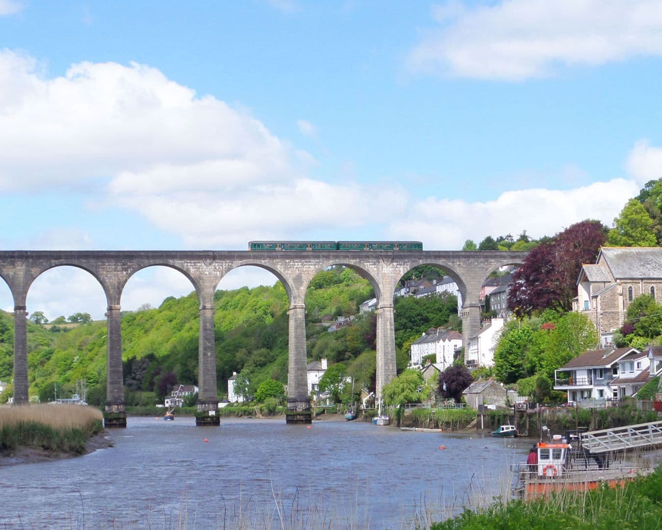
The historic village of St Germans sits at the head of the river valley, although by this time the Lynher has veered off north towards Bodmin Moor where it originates. The quayside sits beneath another fine viaduct and up at the railway station, a collection of vintage railway carriages have been renovated and turned into accommodation. The church, one of the largest in Cornwall, has a fine Norman doorway and sits on the site of St German’s Priory, as does the adjacent Port Elliot House and estate, these days often used for outdoor events including music festivals.
Is this area of Cornwall's National Landscape languishing with one foot more in Devon or in Cornwall? Does it even matter? Probably not because, either way, this underrated region has a little bit of something for everyone - even if they do put their cream and jam the wrong way round on their scones in Devon!
Where to stay
Why not stay a little longer and explore everything this captivating region has to offer? Discover quaint guest houses and charming cottages, unique campsites and luxurious seaside bolt holes.
Things to do
Plan your next adventure and find things to do in this region. Connect with the outdoors, learn more about Cornwall's history, or take a tour to see the highlights of the area.
FAQs
View allThe Tamar Valley National Landscape straddles the border between Cornwall and Devon and covers around 75 square miles of the lower Tamar River (below Launceston) and its tributaries. Apart from a few well known areas around the villages of Calstock and Gunnislake, it is often a very quiet area.
Visitors willing to explore country lanes and secluded footpaths will discover a different side of Cornwall than the one they are used to. Away from the beaches and attractions they will find orchards and meadows, industrial heritage and wide waterside vistas.
Tucked away from the hustle and bustle of the main resorts, you will find farmhouse B&B's, up-market self-catering and village pubs oozing charm. At the same time, towns like Launceston and Tavistock offer modern shopping centres alongside local produce.
- Tamar Valley Line
The Tamar Valley is served by its own branch line which runs out of Plymouth. Called the Tamar Valley Line it stops at Bere Ferres and Bere Alston on the Devon side, before crossing over the river to Calstock. From here it continues to its final destination, Gunnislake.
You can also use the main line to access the station at St Germans on the Lynher River.
Sorry, but you have the wrong continent! The Tamar Valley wineries are in Tasmania, Australia. It's a mistake easily made as you will also find a Launceston in Tasmania.
Here Launceston is a historic market town at the northern end of the Tamar Valley, and an important gateway into Cornwall.
Whilst we may not have wineries in 'our' Tamar Valley there are plenty of places making a good drop of cider!
The Tamar Valley runs between Devon and Cornwall in south west England. The Tamar River being the official boundary for all but three miles in the far north of the county.
Yes, and we would recommend it! In fact it's probably the best way to explore the river.
However, be careful of tides and mudflats. The last 19 miles of the river is tidal, from just below Gunnislake down past Calstock and onwards. Make sure you check the tide timetable before heading out. You should also be aware of weather conditions, especially wind when in the wider sections heading down towards Saltash.
Upstream from Gunnislake there are several weirs which have to be shot or avoided by carrying your kayak around. This stretch, up to Horsebridge is classed as Grade 2, meaning there may be waves and eddies caused by rocks that will need to be navigated around.
A popular day out is from Calstock and takes you to Morwhellam Quay and back. Leave Calstock about one and a half to two hours before high tide. This should give you plenty of time to reach the historic port at Morwellham on the rising tide before returning on the ebbing tide.
Stay connected
Find us on socials and stay connected with the Cornwall you love.