Cape Cornwall to Lands End walk
This is one of the finest coastal walks, not just in Cornwall but also in the British Isles. It has everything from fantastic views, historical interest, stunning beaches, flora and fauna, and the bonus of an open top bus trip back.
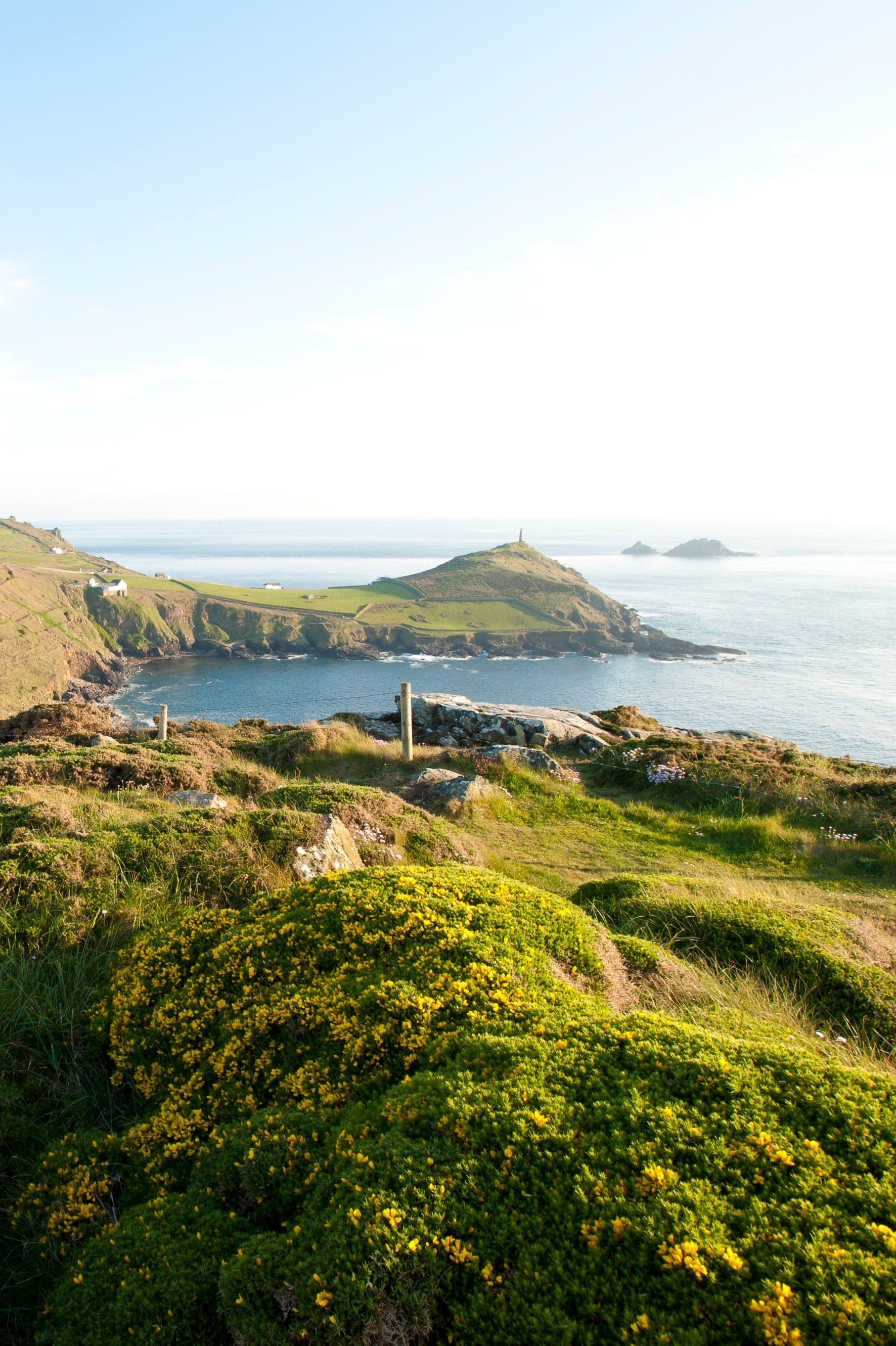
Our walk starts at Cape Cornwall, but you could park in St Just and walk down to the Cape after picking up a few goodies for a picnic? The carpark at Cape Cornwall (National Trust members free) looks across to the cape itself and out to the Brisons, a rocky outcrop a mile offshore that resembles General De Gaulle lying in his bath.
The only cape in England, it marks the spot where the Atlantic currents divide and it’s rare that the sea is calm here. To the south of the headland sits Priest Cove with its fisherman’s huts and man-made swimming pool. There are also several openings in the cliffs at the rear, the remains of 19th century mining that once dominated this area. The chimney on top of the cape dates from 1894, a memorial to all those who worked underground.
Leaving Cape Cornwall, descend the fine set of steps below the car park. These were built as part of the estate connected to the large house that overlooks the cape. Built in the early 20th century for Francis Oats, a miner from St Just who went to South Africa to seek his fortune. This he did and ended a distinguished career as chairman of De Beers. At the bottom of the steps follow the tarmacked track around to the left, then double back to the right, climbing a rough path past some former mine buildings and up to Carn Gloose.
Here there are fantastic views along the coast to Land’s End and over the Cape. A short distance further on a path to the right takes you to Ballowal Barrow, a Bronze Age burial site. Continuing along the South West Coast Path you descend into the verdant Cot Valley. Turn right when you reach the road and head down to the sea. The ‘beach’ here is made up of large round boulders, and it’s illegal to remove them, even if you could life one!
Cross the stream and climb the path until you regain the South West Coast Path. You will see on the left several holes leading deep into the hillside. These are old entrances to the mines, don’t be tempted to explore on your own! If you really want to find out what’s in there, contact Underground Cornwall who offer guided tours.
From here the path winds its way up onto the top of the cliffs, this stretch of coastline is a good place to look out for choughs, a member of the crow family with a red beak and legs. These days rare in Cornwall, they can be seen on the crest of Cornwall and legend says King Arthur turned into one when he died.
The path returns to the shoreline at Nanjulian where more mining remains haunt the valley running inland. The path climbs again and eventually you reach the rocky outcrop at Carn Creagle which you have to carefully climb over. Aire Point lies ahead and beyond that the sands of Gwynver, a favourite with surfers.
It’s an easy walk along to Gwynver, the path following the cliff edge. Don’t get too close, it’s overhanging in places, but do take time to enjoy the views. Walk across the beach when you reach it, feel the sand between your toes if that’s your thing. The South West Coast Path continues again at the southern end, but if the tide is out it is sometimes possible to carry on along the beach (check tide tables first). As you approach the main beach at Sennen, it’s again possible to access the sand, avoiding a slight detour inland.
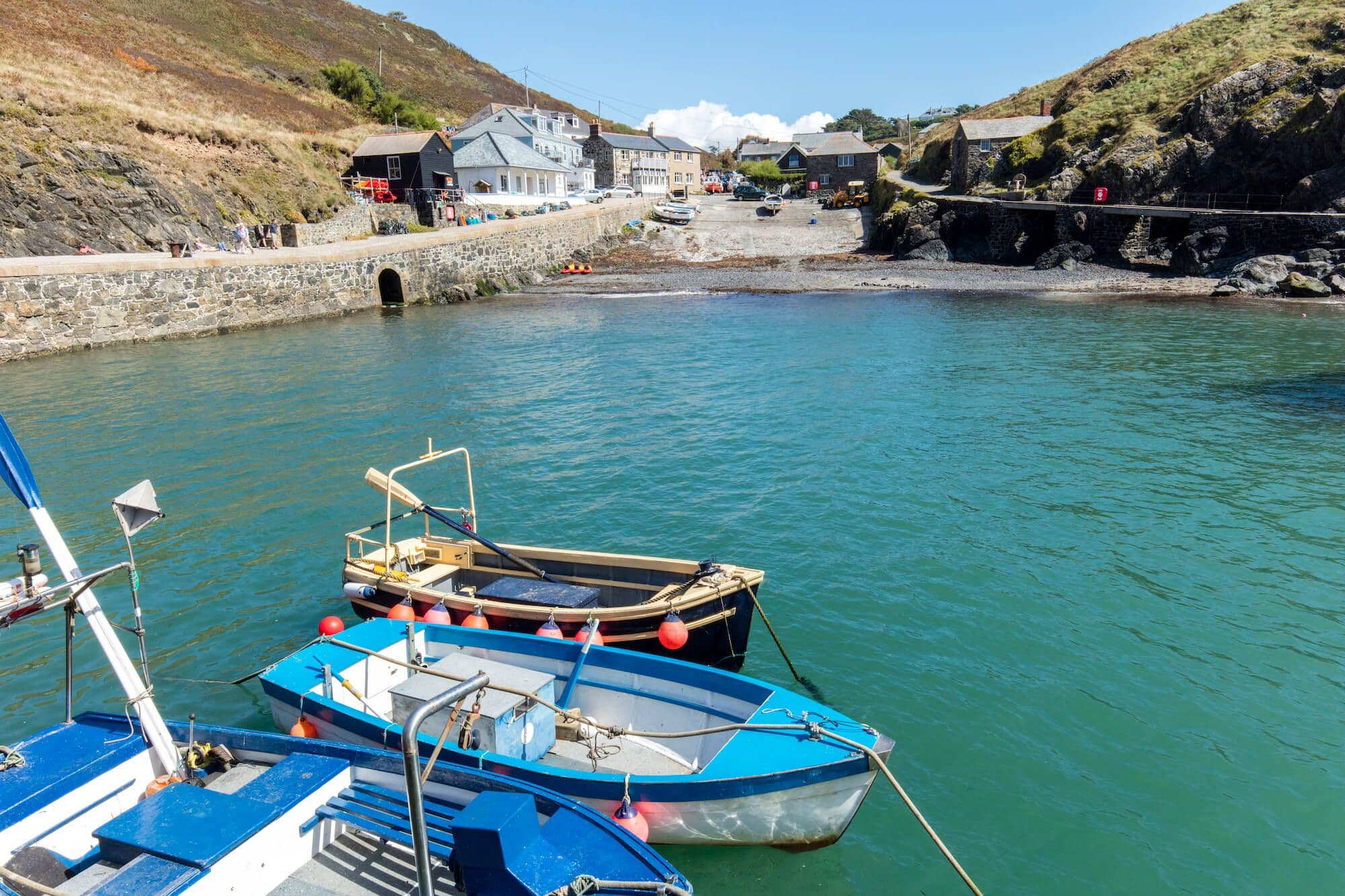
Sennen Cove is a very popular beach, and the village provides all the facilities needed for the high number of visitors who flock here. The Old Success Inn at the top of the second slope off the beach can be a tempting place to stop, but you still have a good mile to walk to your destination.
Continue along the pavement above the beach until you get to the Lifeboat Station. The route now goes past the harbour and through a carpark before turning left and climbing some steps which eventually lead to the small lookout point above Pedn-men-du, the promontory at the southern end of the bay. From here views are spectacular, whilst below you the granite cliffs are a popular haunt for climbers.
From here to Land’s End the path can be busy, a bit of a shock after the peace and quiet of the stretch from Cot Valley to Gwynver. It’s a relatively easy walk just inland from the cliff edge. You pass the wreck of the RVS Mulheim, a German ship that ran aground here in March 2003, please take note of the signs deterring people from climbing down to get a closer view.
At Land’s End you are suddenly greeted by all the trappings of a top tourist destination. You have reached the most south-westerly point of the British mainland, the setting off point, and finishing point of many a journey to John O‘Groats. Like them, your journey is over, you just need to navigate through the gift shops, ice cream and fudge sellers and the many attractions to the bus stop where the Land’s End Coaster will take you back to St Just.
- Land's End / St Just in Penwith
Address
Cape Cornwall Car Park

Stay connected
Find us on socials and stay connected with the Cornwall you love.